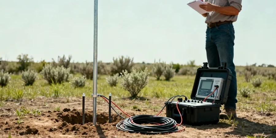
Red Deer sits at roughly 860 meters elevation, right in the middle of the Calgary-Edmonton corridor where the Quaternary sediments can top 100 meters thick. That depth of glacial drift, till, and buried valley fill creates real questions about what lies beneath a site before earthworks or foundation design begins. We run electrical resistivity and vertical electrical sounding surveys to map those subsurface layers without putting a trackhoe on the ground on day one. The method measures how easily current passes through soil and rock—clay conducts, dry gravel resists, and the contrast tells the story. For projects along the Red Deer River or out toward Gasoline Alley, where stratigraphy shifts fast over short distances, a well-planned resistivity line often catches a buried channel or a perched water table that conventional drilling might miss between boreholes. We combine the resistivity data with test pit observations when shallow validation is needed, or integrate it with seismic refraction profiles to cross-check bedrock depth interpretations.
In the Red Deer River valley, resistivity contrasts between dry terrace gravels and saturated silt can exceed 10:1—mapping that boundary accurately is what prevents dewatering surprises mid-excavation.