GEOTECHNICALENGINEERING
RED DEER
HomeGeophysicsMASW / VS30 (shear wave velocity)

MASW & VS30 Shear Wave Velocity Testing in Red Deer

Sound ground. Sound decisions.

LEARN MORE

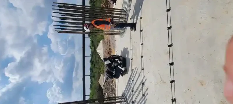
We ran an active MASW line last November on a five-storey residential project off Gaetz Avenue. The developer had assumed Site Class C. After processing the dispersion curves, the average shear wave velocity in the upper 30 metres came back at 265 m/s, placing the site firmly in Class D. Red Deer sits within the Western Canada Sedimentary Basin, where glacial till and lacustrine clay deposits dominate the near-surface geology. The 2020 National Building Code of Canada assigns the city a moderate seismic hazard, but site amplification factors in Table 4.1.8.4.B can double the design spectral acceleration when you go from Class C to Class D. We use the MASW approach with a 24-channel seismograph and 4.5 Hz geophones to capture the fundamental-mode Rayleigh wave dispersion down to 40 metres, then invert the data to produce a 1D VS profile that holds up under geotechnical peer review.

A single VS30 number without the full velocity profile is a liability: the building code cares about the gradient, not just the average.

Our service areas

Methodology and scope

The till in Red Deer can be stiff on top and soft underneath, which creates a velocity inversion that conventional refraction misses entirely. We see this pattern consistently along the river valley escarpments near Waskasoo Creek, where the juxtaposition of compacted silt over normally consolidated clay produces a low-velocity zone between 12 and 20 metres. The MASW method resolves this by mapping the full dispersion spectrum, not just first arrivals. Our field setup uses a 1.5-metre geophone spacing and a 10-kilogram sledgehammer source for active shots, supplemented by passive microtremor recording when we need deeper penetration past the 30-metre target. The raw shot gathers are checked for clipping and polarity on site before the crew leaves. When bedrock is shallow—less than 18 metres, as we have found near the River Bend Golf Course area—the VS30 can exceed 500 m/s, and we recommend confirming refusal depth with a seismic refraction profile to validate the MASW interpretation.
MASW & VS30 Shear Wave Velocity Testing in Red Deer
Technical reference — Red Deer

Site-specific factors

Central Alberta winters impose a narrow field window. Once the frost penetrates past 60 centimetres—common by mid-November in Red Deer—the near-surface velocity artificially increases, skewing the dispersion curve and inflating the VS30 by 10 to 25 percent. We either schedule MASW surveys between May and October or apply a frozen-ground correction derived from parallel seismic cone measurements. The bigger risk is misclassification. A project designed to Site Class C demands that actually falls into Class E can face a design spectral acceleration revision of 40 percent or more, triggering structural redesign, additional piles, or even permit suspension. The City of Red Deer's permitting office now routinely requests the VS30 site classification report as part of the geotechnical submission for buildings exceeding three storeys or 600 square metres in footprint.

Need a geotechnical assessment?

Reply within 24h.

Email: info@geotechnicalengineering.xyz

Applicable standards

NBCC 2020 (National Building Code of Canada, Part 4 – Structural Design), CSA A23.3-19 (Design of Concrete Structures – Seismic Provisions), ASTM D7400-19 (Standard Test Methods for Downhole Seismic Testing, referenced for MASW validation), CCBDA Seismic Hazard Tool (Natural Resources Canada – 2020 National Seismic Hazard Model)

Technical data

ParameterTypical value
Survey depth range2 m to 45 m (site-dependent)
Geophone frequency4.5 Hz (vertical component)
Channel count24-channel spread
Source typeSledgehammer (active) + passive ambient noise
Inversion algorithmGenetic algorithm / damped least-squares
Output resolution1D VS profile at 1-metre intervals
Code complianceNBCC 2020, CSA A23.3 seismic provisions

Frequently asked questions

What does a MASW survey cost for a typical commercial lot in Red Deer?

For a single-family or small commercial lot within city limits, the active-source MASW survey and NBCC site classification report typically range from CA$2,390 to CA$4,700 depending on line length, access constraints, and whether passive data collection is required to meet the 30-metre depth target. Larger multi-line campaigns on industrial parcels fall at the upper end. We provide a fixed quote after a desktop review of the site coordinates and surficial geology.

How deep does the MASW method reach in the Red Deer area?

With a 24-channel spread and 1.5-metre geophone spacing, the active-source setup resolves the VS profile reliably to 25–35 metres. When the 30-metre target is not reached with active shots—common where thick clay sequences attenuate high-frequency energy—we add a passive microtremor recording of 15 to 20 minutes using a circular or L-shaped array. The combined active-passive dispersion curve extends the investigation depth to 40–45 metres in most Red Deer soil conditions.

Why can't we just use the default Site Class C per NBCC?

NBCC 2020 Article 4.1.8.4 permits using Site Class C only when the soil profile is proven by a site investigation to meet the criteria of Table 4.1.8.4.A. The glacial geology in Red Deer is highly variable: stiff till near the surface can overlie soft lacustrine clay with shear wave velocities below 200 m/s. Assuming Class C without a measured VS30 risks underestimating the design spectral acceleration by a factor of 1.5 to 2.0 in the short-period range, which directly impacts the seismic force demand on the lateral system. A measured VS30 is the definitive way to comply with the code and avoid costly structural changes during construction.

Location and service area

We serve projects in Red Deer and surrounding areas.

View larger map