GEOTECHNICALENGINEERING
RED DEER
HomeIn-Situ TestingField permeability test (Lefranc/Lugeon)

Field Permeability Testing (Lefranc/Lugeon) in Red Deer

Sound ground. Sound decisions.

LEARN MORE

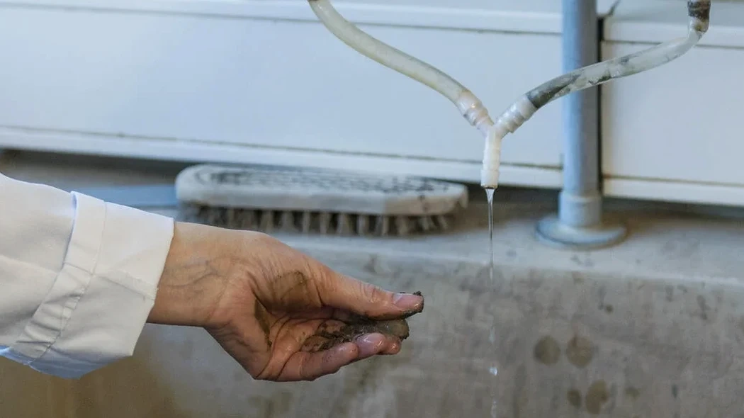
Red Deer's development as a central Alberta hub, strategically positioned between Calgary and Edmonton along the Queen Elizabeth II corridor, has always been intertwined with the Red Deer River. The city's expansion onto the glacial till plains and into the river valley means encountering highly variable deposits—from dense basal till to outwash sands and gravels. In our experience, understanding how water moves through these formations is not a secondary consideration; it's fundamental engineering data. A field permeability test using Lefranc or Lugeon methods provides the direct hydraulic conductivity values that empirical correlations simply cannot match. For projects near Waskasoo Creek or along the steep valley slopes, we combine these tests with a slope stability analysis to accurately model pore pressure conditions. The layered geology here, shaped by multiple glacial advances and retreats, demands in-situ measurement rather than reliance on grain-size estimates alone, especially when designing dewatering systems or assessing seepage under proposed footings and retaining structures.

In fractured Paskapoo Formation bedrock, a Lugeon test reveals secondary permeability that a lab sample will never show—this is the data that keeps dewatering plans grounded in reality.

Our service areas

Methodology and scope

The semi-arid continental climate of Central Alberta, with its freeze-thaw cycles that can penetrate over two meters deep, adds another layer of complexity to permeability assessment. A common scenario we face in the Riverside Meadows or Normandeau areas is a soil profile of sandy silt overlying fractured clay till. The matrix permeability measured in a lab triaxial cell often underestimates the field-scale mass permeability by an order of magnitude because it misses the fractures and sand lenses. That's why we run Lugeon tests in boreholes through the weathered shale and mudstone bedrock of the Paskapoo Formation, while applying the Lefranc method in overburden soils. The data feeds directly into our deep excavation and dewatering plans, allowing us to size pumps and well points based on real field response, not textbook values. Understanding this contrast between matrix and secondary permeability is what prevents costly water management surprises during construction.
Field Permeability Testing (Lefranc/Lugeon) in Red Deer
Technical reference — Red Deer

Site-specific factors

The subsurface contrast between the flat tableland of Clearview Ridge and the lower-lying Fairview district adjacent to the river highlights the risk of assuming uniform permeability. Up on the plateau, you might encounter tight, preconsolidated glacial till with k values in the 10^-9 m/s range, seemingly ideal for a dry excavation. But move down toward the river valley, and the stratigraphy shifts dramatically: buried preglacial gravels and alluvial sands can carry significant groundwater flow with hydraulic conductivities several orders of magnitude higher. Ignoring this transition zone can turn a routine cut-and-cover job into a catastrophic blowout. Even within a single site, we've seen Lugeon values jump from 2 Lu to over 25 Lu across a fractured sandstone bedding plane, meaning a grout curtain designed for the lower value would be completely ineffective. Without in-situ Lefranc and Lugeon data, you're essentially designing blind to the most critical hydraulic pathways.

Need a geotechnical assessment?

Reply within 24h.

Email: info@geotechnicalengineering.xyz

Applicable standards

ASTM D6391-11 (Field Measurement of Hydraulic Conductivity), CSA A23.3 (Design of Concrete Structures - relevant for water-retaining structures), National Building Code of Canada (NBCC 2020 - Part 4, Environmental Separation)

Technical data

ParameterTypical value
Test Standard (Lefranc)ASTM D6391-11 (Variable Head Method)
Test Standard (Lugeon)Houlsby Method / USBR 6510
Soil Types TestedGlacial till, outwash sands, gravels, fractured bedrock
Typical Test Depth Range3 m to 50 m below grade in overburden and rock
Measured Permeability Range1 x 10^-7 m/s to 1 x 10^-2 m/s
Reporting FormatLugeon values (Lu), hydraulic conductivity k (m/s), test logs

Frequently asked questions

What does a Lefranc/Lugeon test in Red Deer typically cost?

For a standard field permeability test program in Red Deer, including mobilization, drilling, and a series of Lefranc or Lugeon tests at multiple depth intervals, budgets typically range from CA$840 to CA$1,510 per test hole, depending on depth, access, and the number of test stages required. More complex setups involving multi-packer systems in deep rock or difficult access along riverbanks will push toward the upper end.

When is a Lugeon test required instead of a Lefranc test?

A Lugeon test is the correct method when drilling into bedrock, such as the Paskapoo Formation sandstone and siltstone that underlies much of Red Deer. The test uses a packer to isolate a section of the rock mass, applying water pressure in stages to evaluate the hydraulic conductivity of fractures and joints. Lefranc tests are limited to soil overburden; once you hit competent rock, Lugeon is the standard for assessing whether grouting is needed to control seepage.

How long does a field permeability test take on site?

The duration depends on the hydraulic conductivity itself. In tight clay till, a falling-head Lefranc test might require 30 to 60 minutes to stabilize. In clean sand or highly fractured rock, the response is rapid and a single stage may be complete in 15 minutes. Including drilling, setup, and a typical 5-stage Lugeon test sequence, plan for 1.5 to 3 hours per test zone. We always factor in time for repeated stages if results indicate turbulent flow conditions.

Location and service area

We serve projects in Red Deer and surrounding areas.

View larger map